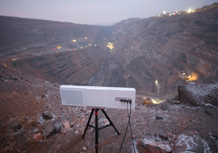
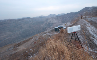
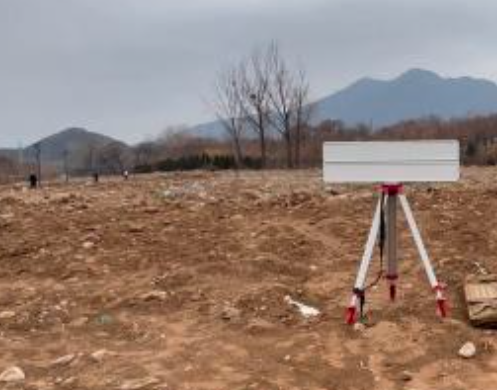
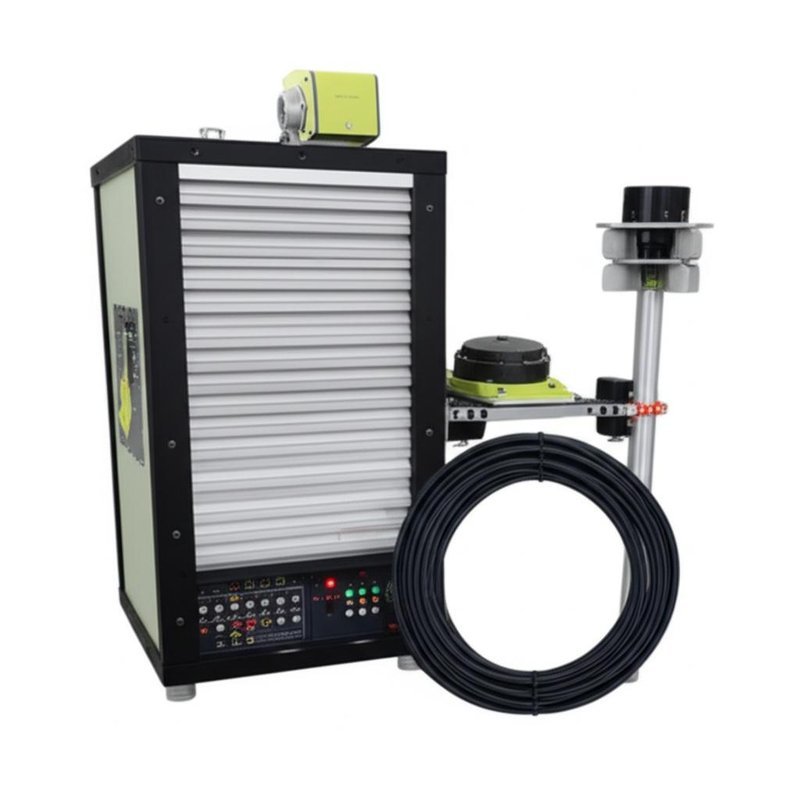
logo
Contactez nous

ContPerson : Yang

Numéro de téléphone : +8618010030825

WhatsApp : +8613436381865

Free call

Portable Digital Phased Array Monitoring Radar with 120° Wide Monitoring Angle and Sub-millimeter-level High-Precision Deformation Monitoring for Slope Safety

Lieu d'origine: Chine Nom de marque: topsky

Détail Infomation

Angle de l'objectif: 120° Peser: 15,5 kg
Rayon: 5-40m, alors que l'intensité du champ est de -75 dBm - Je vous en prie.: 600 m / s (sans plaques de souffle blindé)
Mode de balayage: Scanner de phase Distance de communication: 3000m
Fréquence: 600 à 1800 MHz Vitesse: 2s
Source d'alimentation: Piles rechargeables avec durée de fonctionnement prolongée Suspension: type Quatre point
Usage: Militaire, application de la loi, sécurité Niveau IP: IP67
Poitrine: 824,8 m/s vitesse de croisière: 20m / s
Déviation droite: ≤1,74%
Mettre en évidence:

Sub-millimeter-level high-precision deformation monitoring Slope Monitoring Radar

,

120° wide monitoring angle Ground-Penetrating Radar System

,

All-solid-state design with MIMO technology Portable Digital Phased Array Monitoring Radar

Description de produit

Integrated 3D Slope and Ground-Penetrating Radar System for Slope Safety Monitoring
The PSR-5000T Portable Digital Phased Array Monitoring Radar is an advanced slope monitoring system independently developed and manufactured by Beijing Lintian Intelligent Equipment Group Co., Ltd. Featuring all-solid-state design and MIMO (Multiple-Input Multiple-Output) technology, this system offers significant advantages including compact size, lightweight construction, high precision and superior reliability.
Designed for single-person transport and rapid deployment, this radar system achieves sub-millimeter-level high-precision deformation monitoring when combined with proprietary safety monitoring and early warning software. The system performs large-scale, continuous, high-frequency real-time monitoring of glaciers, frozen ground, surface subsidence, open-pit mine slopes, hydropower reservoir banks, dam slopes, and large-scale structural deformations.
This technology provides early warning and prediction for various collapse disasters and is widely applied in safety assurance, health assessment, and emergency rescue operations for critical infrastructure projects, effectively protecting the lives of rescue personnel and construction workers.
Key Application Areas
Open-pit Mines
Geological Landslides & Collapse
Emergency Rescue
Water Conservancy Dams
Urban Area Subsidence
System Functions & Capabilities
  • Ultra-Long-Distance & Large-Scale Detection
    Detection range up to 5 km with monitoring accuracy unaffected by distance.
  • Ultra-High-Precision Monitoring
    Maximum 0.1 mm sub-millimeter-level precision enables fine-grained monitoring of early-stage micro-deformations for faster and more accurate early warning.
  • Ultra-Light Weight Design
    Complete system weighs less than 14 kg with maximum dimensions of 110 cm × 15 cm × 35 cm, making it portable by a single operator.
  • Ultra-Long Operating Time
    Total power consumption less than 70 W with two power supply modes available.
  • High Spatial Resolution
    Resolution of 0.46 m × 7.5 mrad delivers precise monitoring results and clearer, more accurate imaging.
  • Wide-Angle Monitoring
    120° wide monitoring angle provides broader coverage for large-area monitoring of slope deformations.

Vous pourriez être dans ces
Prenez contact avec nous

Entrez votre message

sale5.ex@topskytech.com
+8613859950250
13311564366
13311564366